|
|
|
Advertisements:
People And SocietyPopulation
No indigenous inhabitants
Ile Amsterdam (Ile Amsterdam et Ile Saint-Paul) Has no permanent residents but has a meteorological station Ile Saint-Paul (Ile Amsterdam et Ile Saint-Paul) Is uninhabited but is frequently visited by fishermen and has a scientific research cabin for short stays Iles Crozet Are uninhabited except for 18 to 30 people staffing the Alfred Faure research station on Ile del la Possession Iles Kerguelen 50 to 100 scientists are located at the main base at Port-aux-Francais on Ile Kerguelen Bassas da India (Iles Eparses) UninhabitableEuropa Island, Glorioso Islands, Juan de Nova Island (Iles Eparses) A small French military garrison and a few meteorologists on each possession; visited by scientists Tromelin Island (Iles Eparses) Uninhabited, except for visits by scientists
Comments
Add a new comment: |
Advertisement
Members area
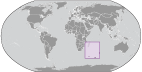
French Southern And Antarctic Lands [ France ]:
 
GPS points from French Southern And Antarctic Lands [ France ]
|
||||||||

 In February 2007, the Iles Eparses became an integral part of the French Southern and Antarctic Lands (TAAF). The Southern Lands are now divided into five administrative districts, two of which are archipelagos, Iles Crozet and Iles Kerguelen; the third is a district composed of two volcanic islands, Ile Saint-Paul and Ile Amsterdam; the fourth, Iles Eparses, consists of five scattered tropical islands around Madagascar. They contain no permanent inhabitants and are visited only by researchers studying the native fauna, scientists at the various scientific stations, fishermen, and military personnel. The fifth district is the Antarctic portion, which consists of "Adelie Land," a thin slice of the Antarctic continent discovered and claimed by the French in 1840.